- News+
- Press Review
- Job Advertisements
- Travel Suggestions
- Retailers
- Directions
- Itineraries
- News+
- Press Review
- Job Advertisements
- Where to Eat
- Travel Suggestions
- Local Products+
- Products
- Producers
- Retailers
- Facilities
- News+
- Press Review
- Job Advertisements
- Accommodation+
- Where to Sleep
- Where to Eat
- Travel Suggestions
- Local Products+
- Products
- Producers
- Retailers
- Points of Interest
- News+
- Press Review
- Job Advertisements
- Accommodation+
- Where to Sleep
- Where to Eat
- Travel Suggestions
- Retailers
- Books, DVDs, and Gadgets
- Natura 2000 Network+
- IT4050004 - SIC Bosco della Frattona
- IT4070011 - SIC-ZPS Vena del Gesso Romagnola
- IT4070016 - SIC Alta Valle del Torrente Sintria
- IT4070017 - SIC Alto Senio
- IT4070025 - SIC Calanchi pliocenici dell'Appennino faentino
- IT4090001 - SIC Onferno
- IT4090002 - SIC Torriana, Montebello, Fiume Marecchia
- IT4090003 - SIC-ZPS Rupi e Gessi della Valmarecchia
- IT4090004 - SIC Monte S.Silvestro, Monte Ercole e Gessi di Sapigno, Maiano e Ugrigno
- IT4090005 - SIC-ZPS Fiume Marecchia a Ponte Messa
- IT4090006 - SIC-ZPS Versanti occidentali del Monte Carpegna, Torrente Messa, Poggio di Miratoio
- Education+
- Education
- Educazione Ambientale Adulti
- Education
- Park Authority

Parco Regionale della
Vena del Gesso Romagnola
Home » Territory » Parco Regionale della Vena del Gesso Romagnola » Itineraries » The Alta Via dei Parchi
16 - Tossignano - Carnè
It is perhaps the most unique stage of the entire Alta Via, almost entirely hiking along the crest of the Vena del Gesso.

- Departure: Tossignano (255m)
- Arrival: Carnè (377m)
- Duration: 8 hour/s
- Difficulty Level: EE (for experienced hikers)
- Length: 19.9 km
- Difference in height: Uphill 1,180m - Downhill 1,060m
- Lap no.16 Alta Via dei Parchi
Accommodation: Rifugio Ca' Carné
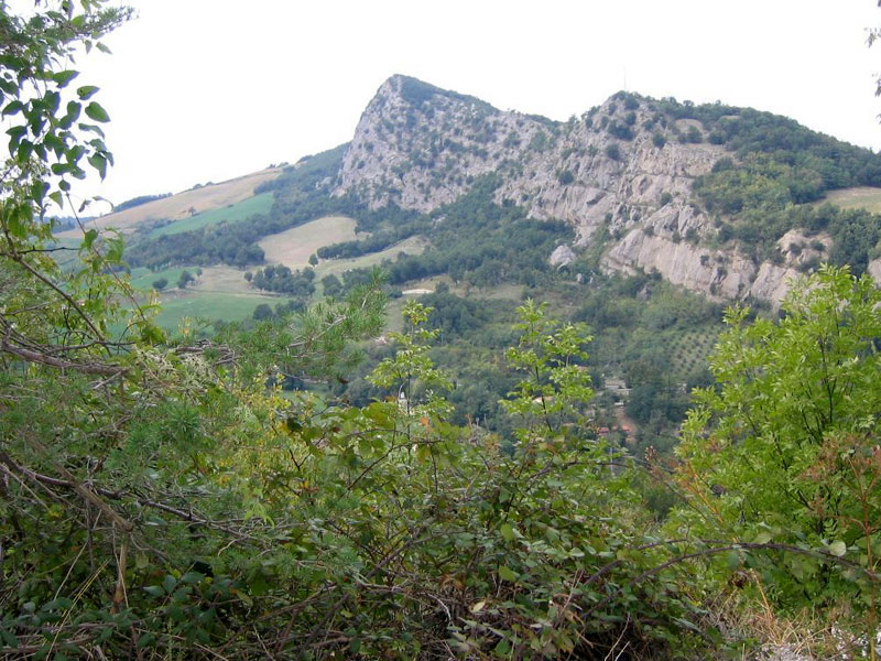
From the remains of the fortress of Tossignano one first descends to the gorge of Tramosasso, carved by the Rio Sgarba into gypsum, and then goes up to the foot of the layered cliffs of the Riva San Biagio. At the next saddle the path on the ridge begins, on the extraordinary rocky ground made of translucent gypsum crystals, where the sunny walls facing south are in sharp environmental contrast with the shadowy chestnut woods covering the slope that faces the plain. After Mount Casino one meets the broad saddle of Cà Budrio, clearly set on a doline, then one continues along the moderate ups and downs of the ridge, until reaching the church of Sasso Letroso. This overlooks the valley of the river Senio, in front of the giant quarry of Mount Tondo. Once down the road in Borgo Rivola, one touches the lowest point of the entire Alta Via route, by hiking the 98 metres of the walkway on the Senio, then one rises again, touching the tiny village of Crivellari and going up the barren slopes of Mount Volpe. From the summit one follows the ridge to the saddle of Cà Faggia, with beautiful views of the blind valley of the Rio Stella, barred by an imposing series of cliffs. One continues on rocky ground, eventually meeting the road that goes up to the panoramic summit of Mount Mauro which is the highest elevation of the Vena at 515 metres. The ancient parish church of S. Maria in Tiberici, recently renovated, is locat- ed nearby. The last descent of the day is steep and leads to the bottom of the valley of the Sintria stream, then one goes up again, through orchards, vineyards and groves, until reaching the north entrance of Carnè Park, and from there the buildings of the Visitor Center of the same name. The Carnè can also be reached from Brisighella (train station) in about an hour's walk.
 Download KMZ


